The Kelpies can be seen near Falkirk.
For walkers traversing Scotland on the 134-mille John Muir Way, the fourth section takes them from Croy to Falkirk. The 20km (12.5-mile) stage of the long-distance route includes only around 175 metres of total ascent. Fiona Russell has enjoyed this section of the John Muir Way on foot.
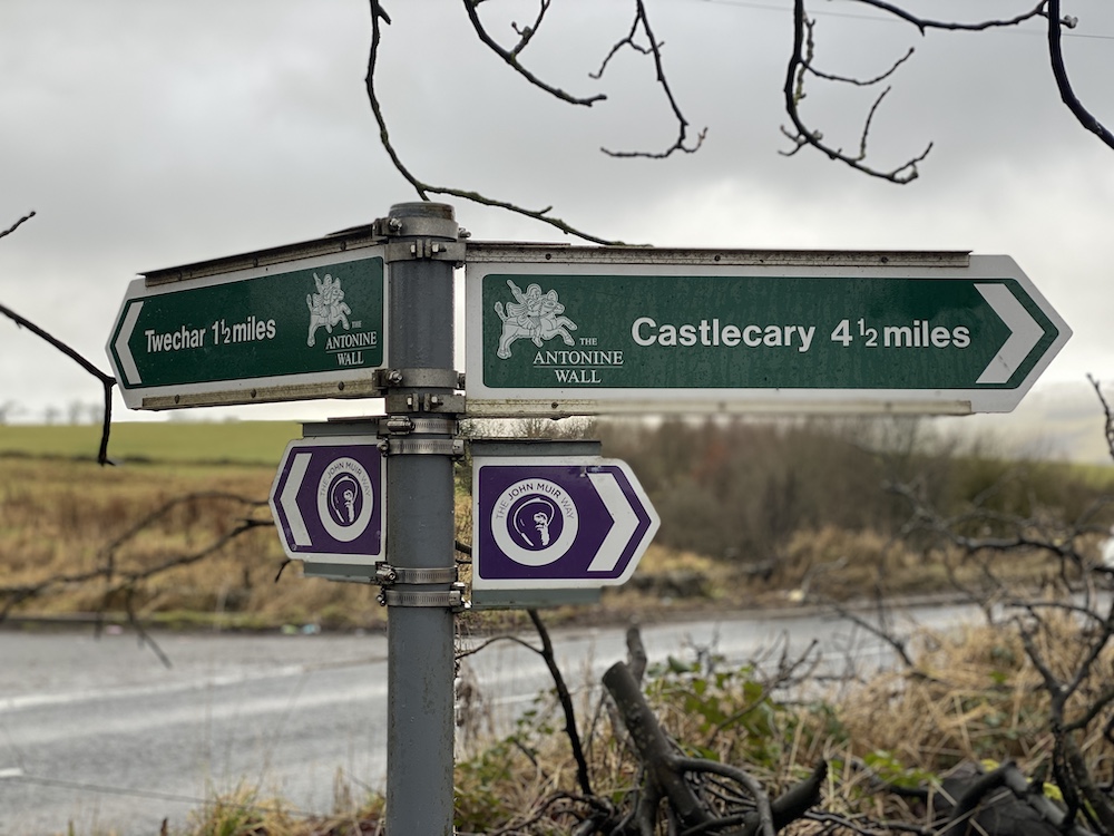
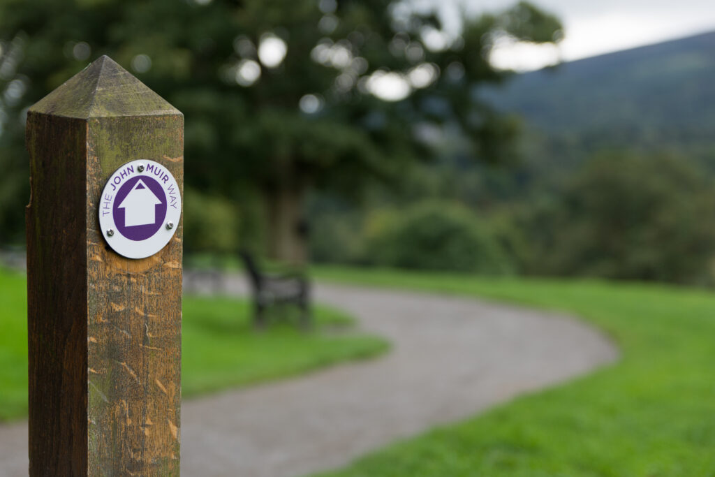
Follow purple John Muir Way signs. Credit: Fiona Outdoors
Walking from Croy to Falkirk
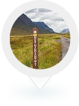
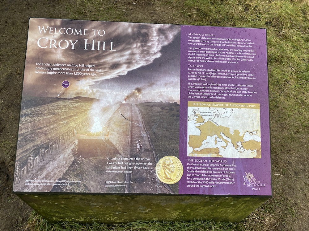
The fourth section of the John Muir Way begins with a walk up Croy Hill. It’s a great small hill that reaches a height of 147m and offers lovely views over to the Campsie Fells, to the north of Glasgow.
In Roman times, the hill was chosen by the Romans as the perfect location for a fort. Today, you will see information boards about the fort and the Antonine Wall.
What is the The Antonine Wall?
The Antonine Wall – known to the Romans as Vallum Antonini – was the brainchild of Roman emperor Antoninus Pius in AD 142 to 143. The wall marked the most northerly boundary of the Roman empire.
The ancient construction comprises a high turf wall, on which a timber fortification once stood, as well as a deep ditch. The wall stretches 37 miles across Scotland’s Central Belt, from the Firth of Forth to the Firth of Clyde.
Excavations on Croy Hill have discovered the site of two forts, as well as a bath house close to one fort.
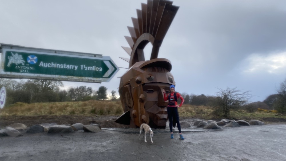
Another modern sign of Roman times on Criy Hill is marked by Silvanus, a giant sculpture of a Soldier, which was designed by artist Svetlana Kondakova.
Croy Hill to Bonnybridge
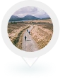
John Muir Way signposts lead walkers from Croy Hill to Castlecary, where you join a short section of road and then cross over the Forth & Clyde Canal on to a towpath on the northern bank.
You stay on the canal all the way to the town of Bonnybridge. At one point, you’ll head through the surprisingly wild area of Dullater Marsh SSSI.
Depending on the time of year, the canal can be busy with pleasure boats and kayakers. Increasingly, you’ll see stand-up paddle boarders, too. Look out for plentiful wildlife as well, including herons.
Also note that the Antonine Wall follows the route of the canal, but stays on the southern side of the waterway.
As you walk into Bonnybridge, you’ll see an unusual vertical lift road bridge. The town is a good place to stop if you want to stock up on refreshments or have lunch.
Bonnybridge to Falkirk
The John Muir Way heads south from Bonnybridge before continuing generally east. Walkers rejoin the route of the Antonine Wall, following the ridge of the old defensive wall.
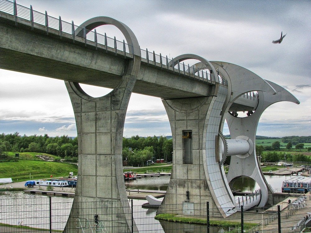
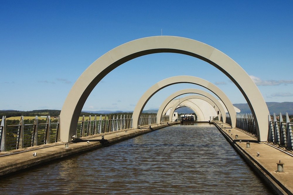
Another masterpiece of engineering, although much more modern is the Falkrik Wheel, which you will soon see looming ahead.
The Wheel rotates to lift boats some 24 metres between the Forth & Clyde Canal and the Union Canal. It was opened in 2002 and replaced a flight locks that once took boats between the two canals that link Glasgow and Edinburgh.
It’s well worth taking a ride on the wheel, especially to enjoy views of the surrounding countryside and to see some of the route that you have just walked – as well as the first part of the route you will be walking next.
The final part of the fourth stage of the John Muir Way takes walkers through Falkirk, where you will see a monument that marks the Battle of Falkirk, as well as the now famous Kelpies sculptures.
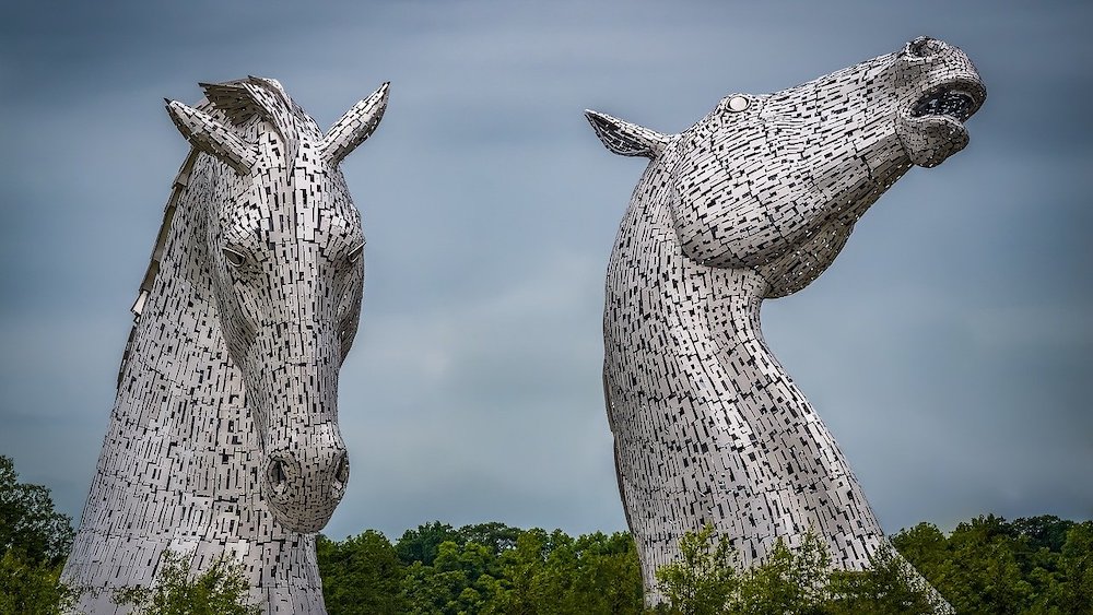
The stunning Kelpies.
The Kelpies – the largest equine sculptures in the world – sit at the heart of Helix Park. They were created by Glaswegian sculptor Andy Scott.
Stop at a bench for views of Falkirk, the Kelpies and the wider countryside.
John Muir Way signposts point towards the Union Canal, where you cross the water on a bridge and head right along the towpath.
The end of this stage is the Falkirk High railway station.
Also read our blogs: John Muir Way: Helensburgh to Balloch and John Muir Way: North Berwick to Dunbar.
Ride Light with Us
We move your bags from door to door. Covering the West Highland Way, An
Turas Mòr, and NC500. Focus on the ride, not the weight.
- Daily Luggage Transfer
- Route Planning
- Local Support


The 2026 season runs from 22 March to 19 October.
offering self-guided walking and cycling holidays.
Scenes from the West Highland Way
Breathtaking scenery awaits at every turn of the West Highland Way


Cape Wrath Lighthouse
Highland Passes
Remote Tracks